09/09/2015 to 09/19/2015
We have not done a true Northwest state trip so we went to Oregon.
This is an amazing state. We started in Crater Lake National Park, then on to Bend to hike and visit friends, and on to the coast.
The scenery is amazing, and the fresh seafood was wonderful. As we drove north along the coast we stopped in one little town after another, enjoying the local scenery and the very friendly people.
- Crater Lake National Park - Overlooks and Lodge
- Mount Scott Hike - Crater Lake National Park
- Annie Creek Trail - Crater Lake National Park
- Newberry National Volcanic Monument - Deschutes NF
- Bend Area Hikes - Bend Oregon
- Dee Wright Observatory - McKenzie Pass
- Covered Bridges of Cottage Grove Oregon
- Oregon Coast Road - Darlingtonia Nature Site
- Oregon Coast Road - Heceta Lighthouse
- Oregon Coast Road - Sea Lions Cave
- Oregon Coast Road - Cape Perpetua
- Oregon Coast Road - Seal Rock State Park
- Oregon Coast Road - Yaquina Bay Lighthouse
- Oregon Coast Road - Yaquina Head Lighthouse
- Oregon Coast Road - Cape Mears Lighthouse
- Oregon Coast Road - Tillamook Cheese Factory
- Oregon Coast Road - Cannon Beach
- Oregon Coast Road - Fort Stevens
- Oregon Coast Road - Fort Clatsop
- Oregon Coast Road - Fort Stevens State Park
- Oregon Coast Road - Astoria
- Evergreen Aviation & Space Museum
Our first stop was Crater Lake National Park. We stayed at one of the cabins - not plush but clean as is true of most accommodations in national parks.
After checking in we drove around the Lake and stopped at the points of interest. Some really incredible pinnacle formations along one trail, misty views of Phantom Ship Island and Wizard Island among other points of interest.
Dinner was at the Lodge and the meals were excellent.

The scenery as you approach the Lodge

The Lodge


The terrace - great place to have a drink and enjoy the view

And the views are just wonderful

Crater Lake

Wizard Island. There is a viewing stand on the hill to the left

You can only get to Wizard Island by the park boat

Really used the long lens to get the boat leaving Wizard Island

These are The Pinnacles


Looking back down the valley - unfortunately the sun was not in our favor


There are some poking up in different spots - pretty amazing


A shot of the road around the lake

Yes, it gets a little narrow in places

We just liked the misty mountain feel

Plaikni Falls


Phantom Ship Island

I do not see a ship but it is pretty mysterious in the mist


Nice shot of the trees and formations on Phantom Ship Island

The boat leaving Wizard Island passes Phantom Ship

Vidae Falls - you can see it from the road

Vidae Falls probably flows better in early spring

Looking at Crater Lake


You can see both Phantom Ship Island and Wizard Island

The water is really blue
We wanted a nice hike that required a bit of energy so we picked Mount Scott. It is only about 2.5 miles each way but the elevation gain of 1,150 feet means you can huff and puff a bit along the way. Thankfully the 7,680 foot elevation is not an issue for us - we hike that often.
The end of the trail is a fire tower. From there you can see Crater Lake and Wizards Island, the surrounding vistas, and some very friendly Golden-Mantled Ground Squirrels.

Driving toward Mount Scott

There were a few active fires - well away from us but burning nonetheles


Starting out on the trail - it is pretty flat at first

That little bump on top is the fire lookout station and the end of the trail


A Golden-Mantled Ground Squirrel - no fear of me that is for sure.

He was just sitting there having a snack.

Little guys are quite bold

More trail

More of the trail - the last section will make you breath hard


More smoke from fires. The ranger said some had been burning for weeks

Closing in


These guys were so funny. One was only in speedos - totally enjoying the weather

Up on top at last

Looking out at the vistas

Another fire

More great views


You can see Crater Lake from the top


This little guy and his friends were at the fire tower

They are way too used to people feeding them and get very close to you


He was busy scarfing down a nut

Yup, my legs


Today we decided on a totally different hike, one that went along Annie Creek.
We really enjoyed this even though it was fairly short. It starts at the top of Annie Creek Canyon and heads down to the creek which meanders along making a nice gurgling sound with a few small falls along the course.
Eventually the trail climbs back up to the canyon rim.
That 200 foot elevation gain is all in the last bit when you head back up to the rim. There are even benches along the way on which to rest should you need it.

Every now and then I get proof George does go with me

Annies Creek meandering

We liked all those pieces of wood that looked a bit like a pile of antlers

Our only wildlife sighting


You get to cross several little bridges along the way

One of the small falls

Ah, another crossing


I think this was the best bridge


One of the meadows

Obligatory mushrrom shot


As you can see green stuff does grow on rocks

Last bridge

Pinnacles


After leaving Crater Lake we headed to Bend to visit our good friends Nancy & Bill. Can I just say now that Bend is the nicest place I have ever been. We never met anyone who was not upbeat and welcoming, including the dogs. But I digress
We did a little hiking around Newberry and the Deschutes forest. Bill & Nancy made sure we got a little taste of everything, just to whet our appetites for the next visit.

Our cohorts Bill & Nancy.

This is a huge obsidian and pumice flow

Obsidian shines like glass

Yes I'm doing my Vanna pointing to obsidian and pumice


The trail winds around all these amazing mounds of rock


Poser

More obsidian and pumice


Next stop was Paulina Falls

A little hike down from the rim provides some great views of the falls


I imagine these really flow in early spring


Looking down the stream from the falls

After the falls we did the little Paulina Lakeshore Loop trail.

This was our wildlife trail

Golden-mantled ground squirrel

Really cute and slightly fluffy deer


Today we did some local things around Bend. We walked along the Riverwalk along the Deshutes River - and as usual it was teeming with folks on paddle boards.
I think it is a law if you live in Bend you must have self-propelled water craft. And a dog. If you do not have a dog you must have at least 2 friends with dogs
Then we drove over to Todd Lake. This gave us a great view of Mount Bachelor - which usually has snow but since it was extremely hot this summer there were only a couple patches. Anyway, we had another great day with Nancy & Bill

Looking down the river

This statue pays homage to the logging industry


The bluffs along the river

A small group of paddleboarders

Goose Butt

Lots of Canada geese

No idea, but we liked him

And this is a typical Bender - paddleboard and dog

Todd Lake

The path is a little obscured but we managed


Yes, you guessed it. A woman on a paddleboard. No dog however

Today we left Bend heading for the coast. We decided to take Route 242 throughThe McKenzie Pass. This is a nice, 2 lane winding road that is usually closed in winter but the conditions today are great and we love these kinds of roads.
The road passes through a huge lava field and offers great views of different mountains like The Three Sisters and Mount Washington.
At the summit is the Dee Wright Observatory. The open structure offers amazing views of the Cascades. It was built in 1935 by the CCC - gotta love those guys.


The CCC used the surrounding lava rock to build the path and structure

The observatory from the road


The entrance

One of the views from the observatory

This compass points to the various mountains and other natural sights

As you can see the lava field is quite extensive

That is Route 242

Gives an idea of the size of these lava rocks

More great views from inside the observatory

Wish I could remember which mountain is which

The Cascades range is really lovely
We love covered bridges so when we saw Cottage Grove - the self proclaimed Covered Bridge Capital of the West - was along our route we decided to find all the bridges we could.
There are several we did not get to, and some of these were really hard to photograph, but what the heck. We feel if the effort is put in to maintaining these we should take the time to see them.

Our first bridge was Goodpasture Bridge

It spans the McKenzie River near the community of Vida


Goodpasture is the second longest covered bridge in Oregon


The Centennial Bridge

The Centennial Bridge is a pedestrian bridge built in 1987

It commemorates the 100 year anniversary of Cottage Grove


As you can see it is light, airy and much better than a bunch of concrete

Dorena Covered Bridge

This was built in 1949


The Dorena Bridge has been bypassed with a concrete span

The bridge now sits in an out of the way area hardly visited it seems


Mosby Creek Bridge

Built in 1920 it is the oldest surviving bridge in the county


As you can see by the tire tracks the bridge is still used

The bridge was restored in 1990

Stewart Bridge

Stewart Bridge was built in 1930 and was used for vehicles until 1982


It was heavily damaged by flooding in 1964 and again by heavy snow in 1968


It was restored in the early to mid 1990s and is now a pedestrian bridge
We drove to the coast and headed North. This leg started in Florence and ended in Yachats.
This is a wonderful road with so much to see.
Our first stop was Darlingtonia State Nature Site. This is a bog, and it is dedicated to the preservation of only one plant - the Darlingtonia californica also called a cobra lily. It is a rare, strangely-shaped plant and is the only member of the pitcher plant family in Oregon.

Welcome to Darlingtonia

The entrance belies what you find in the bog

All you see are the plants


They are quite lovely, although at this time of day and season they seem inactive


More plants everywhere


This give some idea of the height of the plants
Next stop was Heceta Lighthouse. It is still a working facility so you do not go to the top, but the grounds are lovely.
As you park you see the Cape Creek Bridge, a delicate structure that resembles a Roman aqueduct. From there you walk the path up to the lighthouse grounds.
From the beach at the bottom to the vistas at the top you just can not beat the views.


Cape Creek Bridge from the parking lot

We strolled down to the beach

Love the rocks

The first glimpse of the Keepers House

There used to be two houses but no longer

Heceta Lighthouse

Heceta Lighthouse with man in it to give it scale

The lighthouse and outshed

View of the beach from the lighthouse

View of bridge from lighthouse

The beach

Inside the lighthouse


Up the road a bit is Sea Lions Cave. Yes, it is a bit of a tourist trap but how could we pass it by?
Unfortunately for us no sea lions were there - timing is everything you know - but we enjoyed the time there anyway.

Sea Lion Caves is supposed to be one of the largest underground sea cave in America

Loved the totem pole out front

Nice Sea Lion statues

You could see Heceta Lighthouse from the facility


Inside the cave. Apparently this is full of sea lions at peak season

We still liked the cave even sans Otariids

There is this window in one side of the cave. I assume the beach below usually holds sea

The walkway back up to the Visitor Center
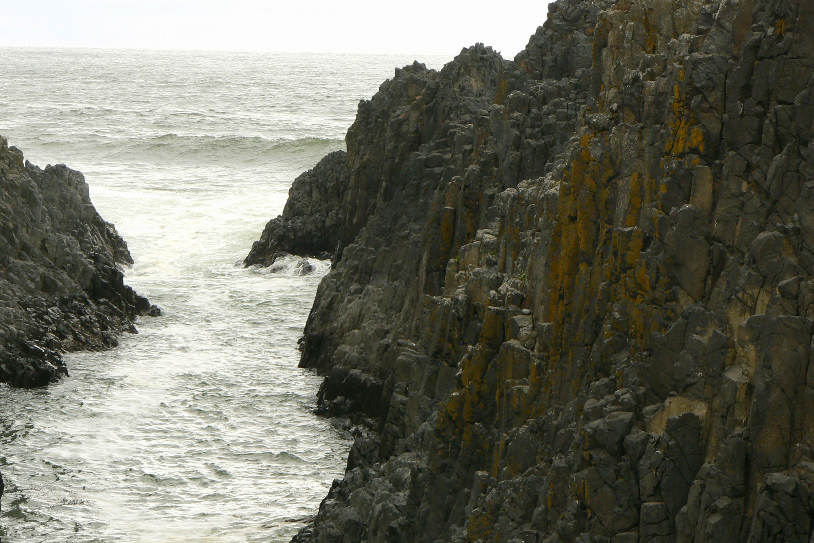
We started our second day on the coast by backtracking to Cape Perpetua - named by Captain Cook because he spotted it on St. Perpetua Day. OK no idea there was such a saint or day but whatever.
As with all these headlands along the coast the views are magnificent. It also has a large tidal pool where we spent a large amount of time jumping from rock to rock and taking pics of whatever we could see.


The West shelter observation point built by the CCC in 1933


Looking down the coastline


This is a thing called The Devil's Churn.

The channel to Devil's Churn

Water rushes in and at times there is a huge water spray


Looking down on the tidal pools


Jumping gingerly from rock to rock

Muscles - not sure if they are California Large or Blue

A green anemone and muscles

Barnacles and muscles

Muscles and some round formation - could not find a name for it

Purple Sea Urchins


Giant Green Anemones


Moving up the coast our next stop was Seal Rock State Park. Oregon has a slew of state parks because the coast was originally the main road for travel. Thankfully they turned them into parks after paved roads became the norm.
Again great ocean settings but no seals. They must have all moved on to some other places we just never found.

ffffffff


Yaquina Bay Lighthouse was only active for about 3 years - being usurped by the Yaquina Head Lighthouse - but it is quite nice and has been lovingly restored and maintained by loving group of people.
The utilitarian tower you see next to it is actually used by the Coast Guard


Looking up at the restored lighthouse and the Coast Guard Station

Yes, the CG station is useful but just not as pretty


Side of the residence

The back

The ladder the keeper had to climb many times each day and night to check the light

The lens - well more or less


The rooms have been restored so you have an idea of how they lived


We loved the stairs and banister


That is the Yaquina Bay Bridge and you can see it from the light house grounds
The Yaquina Head Lighthouse is the tallest in Oregon. It still operates although automated not manually.
The lighthouse is part of a BLM natural area with picnic areas, rocky beaches and trails. Gotta love Oregon and all the parks.
Visiting is regulated and you need to sign up and join a scheduled tour - none fit our time frame so we settled for enjoying the outer areas.

Our first view as we drove up

Along the rocky coast


We saw all those black spots on the rock below

Cormorans and a gull - good thing waves clean the rocks

The beach is a little rocky

This lighthouse sits on Tillamook Bay - yes like the cheese company. It is also part of another state park with trails and viewing areas.
We think this was our favorite. It is small and the tour guide was just so much fun. After everyone else had left the tower we stayed and chatted since there were no other tourists waiting to get up.
The area is lovely and we took our time enjoying all the great scenery and one amazing tree.


The lighthouse is not large


You can see the people in the light room

Inside you get a nice glimpse of all the colors

The mechanism that turns the lens


Unfortunately some kids shot BBs at the light and broke the red glass

It is too expensive to replace so they use a plastic to replicate the look

Those glass decorations in the floor have a real use

Imagine climbing these several times a night


They allow light from the lens to illuminate the stairs and lower area

MOre of that amazing coastline


Rocks with holes


This is the Octopus Tree

It is a Sitka Spruce. No one is sure if natives shaped it for some reason or if the gro


I am in for scale. It is a huge tree
As avid cheese fans we eat Tillamook a lot and just as avidly we love factory tours, so combining both into one was a great idea for us.
We expected this to be a small operation with few visitors but we were very wrong. The place is packed.
The floor we saw was only making the yellow wrapped version - I'm sure the others look similar just different colored wrappers. It was pretty amazing watching all those blocks of cheese whizzing around

Tillamook Cheese Factory. Ever wonder about that ship on the package?

It is The Morning Star. They built it to deliver their product back in 1954

The factory floor

You have to shoot through the special glass so the color is odd


CHEESE


Cheese scraps from the blocking. They get recycled into shredded cheese

This was our stop for the night. We stayed at Tolovana Inn, and there were bunnies everywhere. Why? I have no idea.
After dinner at The Wayfarer we strolled on the beach taking pictures in the dusk.
Next morning we took more pictures because we loved the formations along the beach.
Oh yes, also more bunnies were about so we got a few more of them.

Bunnies everywhere


We loved the brown one. He reminded us of Boomer

Little bunny butt


Amazing sunset over the water


We were not the only ones enjoying the evening on the beach


That little white thing way out on the far rock is Tillamook Lighthouse

The morning brings the dogs. Oregonians love dogs


Once part of the Columbia River defense system Fort Stevens operated until after WW II. Today it is a state park.
Thanks to some dedicated supporters much of the old installations are still standing. It makes for a great stroll through history.

Little history of the area

The first thing you see is this 155mm gun

On to the batteries. This is Battery Pratt


The West Battery

I do not know why one name starts with Battery and the other does not

More West Battery

One of the guns on top of the West Battery

It is the kind that springs up and shoots over the wall

Full view of West Battery

Battery 245

Inside the battery

Those are the rails for moving the shells

Shells


More rooms inside the battery


A bunker

Central Power Station

Inside the power station

Clark Battery - this area did have a large cannon at one time

Inside the building at Clark Battery

Those would be some kind of windows for sight I think


What once held the steam plant

One of the large engines left for viewing


West Battery Command Station

Inside the West Battery Command Station. You do get a long view


One of the shore battery guns


What is left of the mine dock pilings

This is a replica of the fort built by Lewis & Clark for their winter stay of 1805 to spring of 1806. It was from here that they set out for home.
This site has been built twice. First in 1955 to celebrate the 150th anniversary of the expedition.
The planned October of 2005 celebration almost did not happen due to a fire that caused major damage just weeks before the bicentennial. Thanks to the efforts of 700 volunteers it was rebuilt.

Fort Clatsop

Entering the compound


The reconstruction is based on original drawings from the expedition


The larger of the buildings

Inside

One of the outsheds

OK it is the northwest so we must have mushrooms


Down by Nutel Landing.
Fort Stevens has 2 sections. The larger military complex and this smaller one with Battery Russell. Battery Russell has the distinction of being the only place on U.S. soil to be attacked when a Japanese sub lobbed about 17 shells at it during WWII. .
Also part of it is the wreck of the Peter Iredale. This sailing ship grounded in a storm in 1906 and could not be recovered. Most of it was sold for scrap but the ribs and a bit more remain and are an interesting, if eerie, tourist site.


The Lower Ammo Bunker. I was especially fond of the tree

Looks almost hobbit like

Up the stairs. I also liked the sign. Is that an invitation to drop kids in holes?

The Russell battery


Along the walkway


An observation room. Obviously the foliage has grown in since it was used

Up on top


One of the gun mounts


Another gun mount

The South Jetty


A lot of work went into this

The wreck of the Peter Iredale

The beach itself is lovely and well used


You can see the size in comparison to the people


The end of our route on this trip was Astoria.
After a full day of forts we wanted a nice bed in a quiet room and a good meal. We had all three thankfully
Our plan to tour the Astoria Column hit a snag as it is closed for renovations. Scratch one climb and some great views until our next trip there.
We did get some nice shots of the Astoria-Meglar Bridge and surrounding area.

That is the Cannery Pier Hotel - yes there is a cruise ship behind it

This was what we could see from our hotel

The Astoria-Megler Bridge

Old pilings

There was once a cannery here

Who would have thought the India Independence movement has roots in Astoria

The Finnish Brotherhood hall where the Ghadar Party met to oust the British

Astoria Column


Maddening - just small glimpses of the abundant artwork


Looking at the Astoria Bridge from the park

One of the monuments to Oregon Natives
Our last stop was Evergreen Aviation & Space Museum. We wanted to see the Spruce Goose and browse other old planes.
This seems to be a park with water slides, Imax as well as the two aviation museums.
Overall it was fine but they do nickle and dime you to death.

We thought their transport was cute

Spruce Goose - well part of a wing

Another part of a wing

It is way to big to get into one shot

Inside - they only let you go a little way. If you want more it was another twenty-five


Just more planes


I do love the old ones - guess we stick together
